15% off for 2 & 20% off for 3 or more
discounts applied to your basket

Scotland
Scotland Maps
Year of Design 2025
Limited edition - 250 copies available
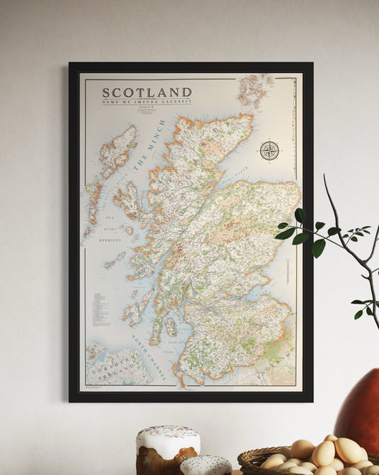
My Scottish map took many months of focused work to complete. The Scottish coastline, plethora of islands and mountainous terrain made it a joy to make and I hope the final product reflects that.
In terms of the subject area it is the largest map I have ever done so a lot of work was done to determine the density and levels of detail across the map that would best serve the design.
The typography is somewhat different from any map I have done before but great effort is made to balance the relationship and distinctions between different fonts and text sixes.
Due to the size of Scotland and the level of detail within the map the only size available is 70 x 100 cm (B1).
If you love Scotland this is the ideal map print for you.
The map of Scotland is available on 270 gsm fine art paper or 280 gsm canvas framed or unframed.
(gsm - grams per sq meter)
For more details on the specifications and build quality click here.


Scotland Munro Map
The design is inspired by antique cartographic styles but is entirely up-to-date.
Details on the map include a complete road and rail network with railway stations. Lochs and sea lochs with labels, lighthouses, castles, council borders and labels.
Islands, bays, peninsulas, headlands and beaches along with a selection of Scotlands most renowned waterfalls.
A significant feature of the map is the labelling of all 282 Munro's in Scotland. Each Munro is named and states its elevation.
A Munro is a mountain over 3,000 ft (914.4 m). They are named after Hugh Munro, who compiled the first list in 1891.
More Scottish Maps
I will soon release many more regional maps of Scotland available in smaller sizes so come back again to check for new releases or subscribe for a monthly news update at the bottom of the page.
My Wales maps are designed to very similar standard. Have a look at those here.


