15% off for 2 & 20% off for 3 or more
discounts applied to your basket
Cheshire
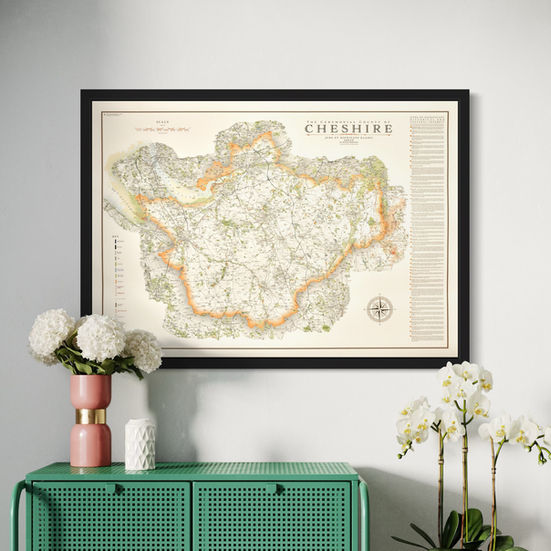
Cheshire was added to my map portfolio in February 2025 having started it just after the new year.
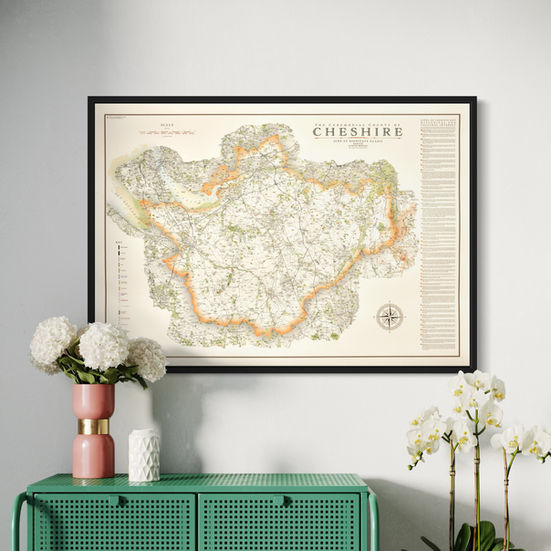
I have included all the detail into the map that my other large county and national park maps have including all the civil parish boundaries, major tracks and paths, hilltops with elevations and complete road and rail networks. All railway stations are also labelled on the map along with the lines they are on.
All the main rivers and canals are plotted and labelled on the map. Cheshire is blessed with a large number of canals, many forming the Cheshire Ring, a popular long boating holiday destination which you can read about in the sites of significant historical and cultural interest.
All the major long distance walking routes are plotted on the map including the Sandstone Trail from Whitchurch in the south to Frodsham in the North. The North Cheshire Way, which runs from Hooton in the West, crossing the Cheshire Plain and finishing in the very north east of the county at Disley, just north of the Peak District.
The hill shading applied to the map brings the topography alive showcasing the difference between the mountainous landscape in the east around the Peak District to the vast Cheshire Plain across the interior of the county.
Take a look at the Peak District maps here
Main Maps
there are two versions of the map. one is of the county as a whole and the other shows the different unitary authorities that make up the county in different blocks of colour.
available in 2 sizes
large - 100 x 70 cm (B1) (original design size)
small - 84.1 x 59.4 cm (A1
framed options available for paper and canvas prints with four frame options available.
Walnut thick and thin frames and matt black in thick and thin frames. There are no difference in prices with the frame choice. Thicker frames look better with larger maps.
Mini Maps
My Cheshire map has also been re-designed for the mini map series with less detail and no 'sites of significant historical and cultural interest' in smaller print sizes
Large: A2 - 59.4 x 42 cm
Medium: B3 - 50 x 35.3 cm
Small: A3 - 42 x 29.7 cm
Visit the Mini Map Series page for more details on the mini map series
sites of significant historical & cultural interest
Jodrell Bank Observatory, The Bridestones, Manchester Ship Canal, The Cheshire Ring, Bridgewater Canal, Anderton Boat Lift, Maiden Castle, Beeston Castle, Chester Cathedral, Chester Castle, Old Dee Bridge, Grosvenor Bridge, Deva Victrix, Minerva's Shrine, Roman Amphitheatre, Chester City Walls Eastgate, The Bear and Billet, Chester Shot Tower, Chester Racecourse, Little Moreton Hall, Peover Hall, Tattenhall Hall, Arley Hall, Eaton Hall, Lyme Park, Bowstones, Ness Botanic Gardens, Cholmondeley Castle, Dorfold Hall, Hack Green Secret Nuclear Bunker, Crewe Hall, Sandbach Crosses, Rode Hall, Gawsworth Hall, Capesthorne Hall, Alderley Edge, Tabley House, Nether Alderley Mill, Tatton Park, Dunham Massey, Quarry Bank Mill Bramall Hall and Adlington Hall.


